ZenaTech Launches ZenaDrone IQ Quad Autonomous Drone to Boost Surveying and Geospatial Services
27 Jan 2026
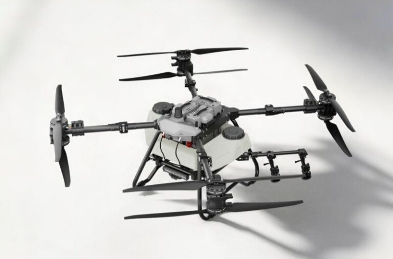
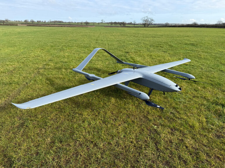
ZenaTech, Inc. (Nasdaq: ZENA), a global provider of AI-powered drone-based technology solutions, Drone as a Service (DaaS), enterprise software, and quantum computing, announced the launch of the ZenaDrone IQ Quad, an autonomous VTOL drone designed specifically for surveying, construction, urban planning, and public works applications.
Developed and manufactured by its subsidiary ZenaDrone, the IQ Quad is geared toward fast, high-precision surveys and will initially be deployed at select locations on the company’s Drone as a Service platform for operational testing, followed by a wider rollout at its DaaS sites in the United States and internationally.
The launch reinforces ZenaTech’s strategy of delivering AI-powered autonomous solutions for data-intensive industries. The surveying market represents a high-growth opportunity, where speed, accuracy, and repeatability are critical factors for productivity and decision-making.
The IQ Quad is a mid-range enterprise drone with a quadcopter design, compatible with high-resolution sensors such as 4K cameras, LiDAR, multispectral sensors, and thermal sensors, enabling the capture of detailed geospatial data even in complex environments. It integrates advanced obstacle detection, terrain following, and 360-degree situational awareness cameras to enhance safety and operational performance.
The platform is designed to generate professional topographic maps and 3D terrain models, used in infrastructure projects, real estate development, and land-use planning. Its weather-resistant carbon fiber structure, foldable arms, and autonomous charging capability at charging stations facilitate field deployment. The drone offers a flight time of up to 45 minutes, a range of up to 5 km, and a payload capacity of 2 to 3 kg, allowing the use of multiple interchangeable equipment.
According to industry projections, the global drone surveying market could grow at an annual rate exceeding 19%, increasing from approximately USD 2 billion to over USD 11 billion by 2033, while the overall geospatial and mapping market could surpass USD 50 billion in the next decade.
ZenaTech’s Drone as a Service platform modernizes traditional field services through on-demand and subscription-based solutions, including surveying, inspections, maintenance, precision agriculture, and asset management. The company currently operates 19 DaaS locations in the United States and three internationally, consolidating a scalable network with recurring revenue and high growth potential.
Source and Credits to ZenaTech
For more information click Here